Saturday, August 28, 2010

The trail ends at Machu Picchu

Bienvenidos a Machu Picchu, One of the Seven Man Made Wonders of the World.


View from the top of Machu Picchu--isn't it breathtaking! Margaret insisted we be on the mountain to watch the sunrise. It was worth the 4:45 wake-up call. We were on the bus at

5:30 am, thinking we'd be the first bus load on the mountain. Alas! We passed 5 buses going down. Each time our bus came upon a descending bus, one bus or the other had to pull tight against the mountain or precariously close to the side. Our guide Senior Will took us straight to the top, easier than it sounds. The steps (stones) were narrow, steep, and the altitude and climb left us breathless, well except for the kids who scrambled up like mountain goats.


We arrived by train in Aguas Calientes on Friday night after our day-long tour through the Sacred Valley. We had one of the finest buffet lunches of the trip in the Sacred Valley. Aguas Calientes is at the bottom of the picture. You can see in this picture the steep climb the buses must make to get to Machu Picchu.

This bus is one of a large fleet of buses that make the multiple hair pin turns up the side of the mountain. The drive is historic in that Hiram Bingham and his men hacked their way through the jungle to reach Machu Picchu which was virtually hidden from the Spanish Conquistadores. It is the only Inca city not to have been plundered.

The two-hour Vista Dome train ride from Ollantaytambo was interesting. We were served a light dinner. We arrived at Aguas Caliente in the dark. After walking through a dense market of all sorts of goods (a real tourist trap if one has the energy to stop and buy), we made our way across the train tracks to our hotel which turned out to be a really fine, small, new hotel. Our room was on the river and we fell asleep to the sound of rushing water. Margaret and Ted's room and the Kids' room was on the street/RR tracks side and they were awakened several times by trains.

Kate and Spencer are sitting on a stone cut by the Incas to match the mountain scenery. The pamplet we were given at the gate explains that in 1874, the German cartographer German Gohring had already registered the names Machu Picchu and Wayna Picchu. Also a farmer, Augustin Lizarraga, explored agricultural lands in 1900 and knew of the site. Other settlers knew of Machu Picchu, but Hiram Bingham, a North American professor, is credited with the discovery. He was interested in the military campaigns of Simon Bolivar, the liberator of Peru. He and his translator started the journey from Cusco, on foot, and following the direction of the Urubamba River, they came upon a farm where they met a farmer who had heard of the "ruins at the top of the mountain." He farmed the terraces on the lower part of the site. A child actually led Hiram Bingham and his translator to the ruins. The local farmers called the site Machu Picchu which means "the old mountain." The actual date of discovery, marked by Hiram Bingham, is July 24, 1911. In 1912 he returned with a group of archeologists. The project was funded by Yale and the National Geographic Magazine. Peru now maintains the site through the National Institute of Culture Cusco.

Mountains are sacred to the Inca. This rock mimics Wayna Picchu, a steep mountain across from Machu Picchu. In order to hike the mountain, hikers have to be in line about 5:00 a.m.

The round tower-like structure is the temple of the sun. Notice how the sunlight is reflected on the massive center stone. The Inca's sacred date to make sacrifices to the sun is June 21, the Southern Hemisphere's first day of winter. Their sacrifices were a petition for the sun not to die. This is the only temple in the city not to have been restored some.


Here we are at the top. When we were here in 2006, I wore out before we got to the top. My legs went to jelly and my heart felt as if it would pound itself out. So when Senior Will took us to the top first, it made all the difference in our tour experience for me, but even for all of us. We spent about an hour at the top taking pictures and listening to Senior Will's history, archeology, and cultural lessons. When we started down to visit the individual homes, temples, and other sites, we were rejuvenated. Senior Will even pointed out to us great photos and gave us time to take the pictures. For Stuart to be at the top so long was really special because the guide we had in 2006 must have had another tour because he hurried Dad and Jim and Joan off the mountain after just a few minutes.


Our guide in 2006 told us the green plaza to the left and rear of the picture was a playing field. Senior Will laughed at that and said they did not have time to play games. It was a plaza like the Plaza de Armas.


This picture is looking off the back side and across Machu Picchu. The city was extensive. Interestingly enough, more bones of women were found in the excavation leading Hiram Bingham to wonder if Machu Picchu was a university or sacred site for women.

I pulled the zoom in tight for this picture. It's almost haunting with the sun rays and the shadowed mountain range behind Wayna Picchu.

The Inca believed in a pre earth life, earth life, an after life. There are depictions of the tree of life in their art as well. This stone is half of the Inca Cross which reflects the different levels of life, their worship of the heavens, the sun, the moon, and the earth or Pachamama. Interesting!

The stones in the foreground end the Inca Trail from the mountain behind. We are standing at the front door or original and untouched entrance to the sacred site of Machu Picchu. You can get a sense of how high we are by looking down to the right.

These are the lower terraces and houses. The rope has something to do with agricultural testing.

This is another view of the back side and Kate who was drawing her impressions of Machu Picchu in the dirt.

They say kids listen even when they aren't paying attention. It's true. These two artists were really listening to Senior Will.

This is the energy stone. The stone is believed to store energy from the sun. I did it! I had enough energy to go the distance....hmmm

This is the temple of the condor, a sacred symbol for the Inca. The rock walls above are the wings of the condor. The right wing is visible and on top of the wing is a temple. There was no way to step back and get the full picture of a condor, but the bird was there all right. Behind it is the sacred burial tomb.

While we were waiting for the buffet lunch at the Sanctuary Lodge, we found a cool spot under a natural arbor where the guides go for their lunches. A woman provides lunch for all the guides and workers who pay her. Her little boy was so cute. He is not walking yet. He seemed to be totally oblivious to the jagged stones.

This moss covered piece of wood seems to have been carved into the shape of an animal. A horse? A dog? Who knows, but it made a cute picture.

Emma got on for "a ride."

It is late winter in Peru, but at Machu Picchu, according to our guide, it is spring. There are something like 132 climates in the world. Peru has 82 of them. This is a wild lilac in full bloom.

Thursday, August 26, 2010

The Road to Machu Picchu...through the Sacred Valley

The Inca trail is a picture at every turn. This is a picture looking down into the Urubamba Valley, the valley and river which Hiram Bingham followed to find Machu Picchu. In these hills are singular Inca storage houses, rocky burial caves, and grand Inca estates.


This view of the Urubamba valley is spectacular. We had stopped at a roadside market--well, it was supposed to be a place to take pictures, but of course, there was a fairly good size market along the road. We bought ceramic water whistles and some inexpensive jewelry.


Margaret had read about the Pisac Market and really wanted to see it. The Hursts and Dad and I visited the market in 2006 as part of our guided tour from Cusco to Machu Picchu and thought it was amazing--bags of corn, beans, many varieties of potatoes, herbs and seeds. The food stuffs were at the beginning of the market which seemed to stretch across 100 yards. There were stalls of sweaters, rugs, toys, and touristy memorabilia, fine jewelry, silversmiths, etc. This trip the Market was not part of the tour because it was not set up in Pisac. After the March floods, the villages held their own markets like the one we only looked at as we were walking toward the ruins of Ollantaytambo. I managed to shoot this picture as the van was pulling out of the congested parking lot.

This is the official flower of Peru which looks suspiciously like the copiahue flower of Chile. Ofelia, our guide, said it is from the same flower family. The trumpet vine Grandpa had growing in the backyard of the house on 11th Avenue and at the St. George house must be from the same family.
The Inca used terraces for farming and for grazing llamas. You can see the construction of the terraces clearly here. We also learned that pre Inca cultures used terracing as well. In the Lake Titicaca pictures, there is evidence of pre Inca terracing. Those pictures will be in a later blog.

We stopped at an Inca burial site and storage houses built into the hillside. This was the beginning of the trail which led to the storage houses high in the hills. Emma and Margaret are standing on the narrow path not far from the boulder.

This picture is looking down into the Urubamba River and valley. Some die-hard hikers hiked the Inca trail through the valley and along the river to reach Machu Picchu. I think I read it is a 4-6 day hike. We preferred the vans, train, and bus.

These steps Ted is descending date back to the 1400s. The Inca built steps on the outside of their walls.


This is a close up shot of the terraces used for gardening. They are more than 500 years old. Look to the upper right of the picture--the holes are burial caves. More than a 1000 mummies were found in excellent condition because of the burial practices of wrapping in a heavy woven material and placing the bodies in the fetal position for travel to the next life.

This is a cemetary! You can see countless holes or burial sites over the entire hillside.

While Dad and the Jeffries hiked to the storage houses you can see at the top and middle of the picture, I stayed on a lower path and took pictures. Each one of these terraces has a micro climate of its own. The Incas fertilized only the top terraces and allowed the rain to carry the nutrients to the bottom terraces.

I took this picture of Ted photographing this massive boulder which blocked one half of the already narrow road. The van barely made it around the boulder. Ofelia said it has been there since the heavy rains in March because there is no way to move it or dispose of it. Go figure!

Ollantaytambo is spectacular. This was a royal Inca stronghold, a fortress of magnificent size and area in the Sacred Valley. It connects strategically with the Inca Road to Machu Picchu, and it is about 2 hours from Cusco. The scenery is breathtaking and no camera could do it justice--high mountains still covered with snow, verdant hills, and a lovely valley of homes. Ollantaytambo is a living city which depends now on the tourist trade. The town offers guided bike tours and trails, fishing trips, hiking, and rock climbing.

Ted, Margaret, and Kids are on one of the terraces in the center. They climbed the stairs to the top and came back by the same stairs. We lost track of them and thought they had taken a narrow trail across the mountain.

The Jeffries are in just below on the staircase on the left. At the top are several homes and storage buildings. This site dates to the 1400s. To the right is a fountain which I thought I had a picture of. The fountain is four-sided. Water is collected from the streams and funneled through narrow aquaducts into four distinct natural fountains. I commented to Dad that I wished we could have such a water feature in our back yard. The Incas knew how to harness water, to channel sunlight, how to tell time by the sun shining through trapezoidal windows in their houses and temples, and how to use moonlight to plant and harvest.

SACSAYHUAMAN

Sacsayhuaman is an Inca fortress built about 1450 by Pachecutec, the Inca governor who consolidated the Inca Empire. There is also evidence it was used as a place of learning, possibly a university for the nobles. Our guide, Ofelia, did not tell us about the university. We learned that when we were in Cusco in 2006. We had a private van. Our driver took a narrow, steep, scenic road just out of the city limits to reach the site.

We entered Sacsayhuman from high above the stone walls. Actually, we entered through a stone cave, at one point quite dark and disarming. We exited onto what seemed like a broad playing field. The view down to Cusco was really beautiful.

This is just one small section of the massive wall of stones. There is evidence the wall was much higher and, like other Inca structures, this wall has no mortar. The stones are fitted perfectly together. The stones incline or lean into the center. The inclination of the stones strengthens the wall. Ofelia had pointed the inclination out to us at the sites in Cusco.


From this side of the great stone which weighs about 20 ton, the upper walls are visible. It is one of the upper walls that was washed out in the heavy February and March rain storms.
One wonders how they moved such a stone into place or for that matter hoisted the other stones to fit so snugly. Ofelia said there is evidence they used logs to roll the stones from the quarry which was up on the upper ledge. But how they lifted them in place is somewhat of a mystery. There was some kind a pulley system, one guide told us.

Ofelia pointed out the angles of the stones, somel 12 sided. Notice the varied shapes.

Emma saw the Utah stone first. Of course, we had to have our pictures taken in front of it. A few minutes later we found another even more pronounced Utah shaped stone.

This picture is deceiving. The walls look short and close together. The truth is we are on the high bluff overlooking the walls. Where we are standing has been recently excavated and developed. We walked down a mountain-side of stone steps to reach the field and the great stones. When we were there in 2006, this area was under excavation.

We were on our way out of the site when Ofelia offered to take this picture. You can see the city below and the end stones to the great wall.
While we were standing on the upper plateau, this man, who looked very much like a North American Indian, walked past us, settled himself against one of the terraces, and began to play music which sounded very much like North American Indian music. The sound of his recorder echoed off the stones. It was hauntingly beautiful and a little distracting because it was hard to follow Ofelia's history lesson.

We appreciated Ofelia so much. She led us to this rock slide so the kids could have some play time. Throughout the 10 days, we recognized the value of having private guides and vans because we could do some fun or side things we couldn't have done if we had been with a busload of people.
Spencer and Kate were ready to race down the stone slide. The ride is not a short or smooth one. I didn't consider sliding. Even Margaret and Stuart were happy to let the kids slide. But Ted...he went up to sit with Kate and slide with her. What a guy!

Emma, Spencer, and Kate decided to race together. The close up gives shows the cracks clearly. The slide was not smooth even though they chose a shorter, seemingly smoother part of the slide.

Tuesday, August 24, 2010

The Beautiful City of Cusco, Peru

On Wednesday evening, the 11th of August, 2010 , we arrived in Cusco after a long drive from Puno . The drive was pleasant because we stopped at the pre-Inca and Inca sites, a Quechua family's home, and Inca stomping grounds overlooking a beautiful lake.

We were struck with the beauty of Cusco, its well maintained buildings, narrow, one car streets, fountains, and monuments. The Inca laid out the city in the shape of a puma. The puma represents this earth life. Cusco is the historic capital of Peru and the main tourist attraction because of its role as the center of the Inca Empire which stretched from Ecuador to Chile. Javier Since, owner of Moroni Tours, recommended the Inca Grill for lunch. The balcony where we are seated overlooks the Plaza de Armas and the two massive cathedrals that anchor the square.

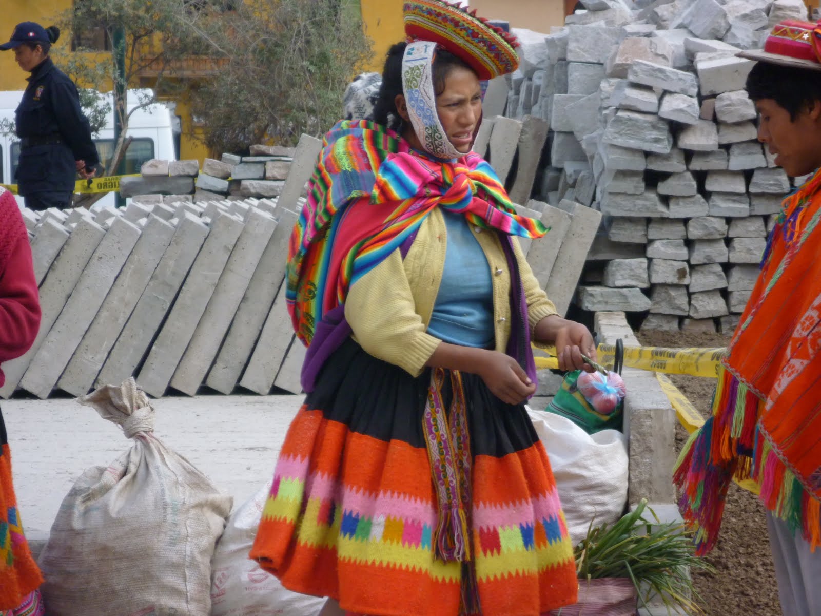
One of our stops was an artesania shop where the work of local artisans was displayed. Each article--bags, place mats, table runners, table cloths, glass cases, etc., includes a picture of the woman who wove and created the article. The shop is really set up as a foundation which assures the weaver/artist she will be paid the worth of her work. This woman was quite shy but she allowed us to take her picture. We paid her. It is expected and appreciated.


A former cathedral is now the Koricancha Museum, a museum of Inca walls and rooms found in tact. The Inca used no mortar. The stones are honed to fit so closely together, a piece of paper could not be inserted between the stones. The Spanish used the massive blocks of stone as foundations for their cathedrals, churches, and palaces. In this doorway you can see the Inca blocks of stone and the Spanish door and embellishments on the stone. The monastery still functions today but we were not allowed to visit there.


The head of the Puma is at the upper left of the photo. The road just left of center forms the body of the puma. The tail comes to the point in the city where two rivers come together.

The roofs create a uniform pattern of brick red throughout the city. Cusco, the gateway to Machu Picchu, depends on the tourist trade. Three massive, important, and beautiful Inca sites are within minutes of the city. The architecture is a mix of Spanish Colonial and mixed with the ancient sights of the Inca Empire.


On Sunday we went to Sacrament Meeting in a chapel a few blocks from the hotel. The building was behind a massive iron fence. The architecture of our chapels, whether one story or two, is distinctive. They are attractive additions to the city.


We rested in the afternoon. About dinner time we ventured out to find a place to eat and ran into a Catholic celebration of the Virgin Mary. Notice how big the statue is. More than a dozen men were carrying her through the streets to the cathedral. A ragtag band followed playing the same eight bars of music over and over.


We toured the Catedral de Cusco which is more an art museum than a place of worship; however, services are held there. The main altar is dedicated to the Virgin Mary. Our guide pointed out the 15th Century religious art, the gold altar, and the side chapels of silver. The story is that the Spanish looted the silver and gold and built their cathedrals over the Inca temples. We could see three centuries of stone work in the buildings and surrounding walls.


This picture really belongs with the other Inca stone work in the basilica and monastery. This cathedral, one of three) was also built over the Inca walls and rooms. The great blessing is that the Spanish conquistadores didn't tear the temples down. They just built over the existing temples and sacred Inca sites using the massive blocks for foundations.


This picture was taken from the balcony of the Inca Grill. One of the things we enjoy about Peru is how the locals use their parks for gatherings. They are always well maintained and safe. You can see the two main cathedrals that flank the square.


This is a side view of the Koriancha Musium and the monastery. We were not allowed to go beyond the cloisters and garden.


This picture of the main cathedral was taken the first day we were in Cusco before we went to Machu Picchu. There were fewer people walking around that day. Sunday the plaza and cathedral were congested. Selling jewelry or any other memorabilia is against the law in Cusco, but the vendors are hard at work from the first light and into the night. One lady approached me on the side steps to the main cathedra to sell me a piece of jewelry. I had seen a llama pendant I liked earlier in the day so I looked her tray over and didn't find what I wanted. She said she would get it from me but I didn't see her again which was a relief, actually. We figured she had been chased off the cathedral steps by the police.


You can see the cobblestone and brick road in this picture. Also you can get a better sense of the size of the cathedral.


The balcony of this building is where we sat to eat lunch at the Inca Grill. In spite of still being in winter, the flowers were just gorgeous. We learned that there are 132 ecosystems in the world and 82 of them are in Peru. Cusco is warmer than Lima and sunny almost every day.


From this aerial view, you can see the main square and the three cathedrals.


The Peru flag is the red and white flag and the Cusco flag is the rainbow flag in the background. Jewelry made by local silversmiths reflects the colors of Cusco--the rainbow Inca cross, for example. Each color has meaning and corresponds to the life cycle. The Inca believed in pre-earth life, earthlife, and the life beyond. Our guide told us the reason Pizarro and his men were readily accepted in the beginning was because the Inca believed Pizarro was the great white god they expected to return some day.